Bentley Wood - WML

Final details: A PDF can be downloaded here
A West Midlands League regional event suitable for everyone from the absolute beginner to the experienced orienteer. Bentley Woods is OD's best area as used for Level A events such as the Midland Championships or the British Night Champs. The 2023 map can be found on Routegadget here
Access from the A5 / B4116 roundabout at the west end of the Atherstone bypass, Travel SW via the B4116 and then turn back towards Atherstone along Coleshill Road to the estate access road, Do not access from the NE through Atherstone
Entrance to Car Park:
Map Reference: SP290966 Nearest Postcode: CV9 2HF.
What3words: ///autumn.chained.udder Streetmap: http://www.streetmap.co.uk/map?x=429098&y=296637
Parking: There will be a charge of £2 per vehicle which must be booked & paid for when entering. We may need to limit the number of vehicles depending on weather conditions. If there are no car parking places left when you enter, you must arrange to travel with someone who has already booked a space - or arrive by another means of transport.
Start times: from 10.30 to 12.30.
Newcomers and non-members: can reserve an entry by emailing entries@octavian-droobers.org or can enter on the day at the event.
EOD (Entry on the Day) Some courses may be restricted by the availability of printed maps. See table below for EOD map availability...
Senior British Orienteering member £14 (Non-Member £16)
Juniors £4 (including full-time students)
SI card hire £1 (Non SIAC)
Courses: White (Shortest) to Brown (Longest) Final as sent for printing.
| 1 | Brown | 9.7 km | 280 m | 27 controls (double-sided map) | 6 EOD maps |
| 2 | Blue | 6.7 km | 180 m | 22 controls | 9 EOD maps |
| 3 | Green | 4.7 km | 125 m | 17 controls | 9 EOD maps |
| 4 | Short Green | 3.4 km | 95 m | 12 controls | 7 EOD maps |
| 5 | V Short Green | 2.4 km | 70 m | 12 controls | 8 EOD maps |
| 6 | Light Green | 3.5 km | 110 m | 14 controls | 4 EOD maps |
| 7 | Orange | 2.9 km | 85 m | 12 controls | 6 EOD maps |
| 8 | Yellow | 2.3 km | 60 m | 12 controls (text descriptions) | 4 EOD maps |
| 9 | White | 1.6 km | 40 m | 11 controls (text descriptions) | 7 EOD maps |
SI Punching: SIAC enabled. Punch the start and finish.
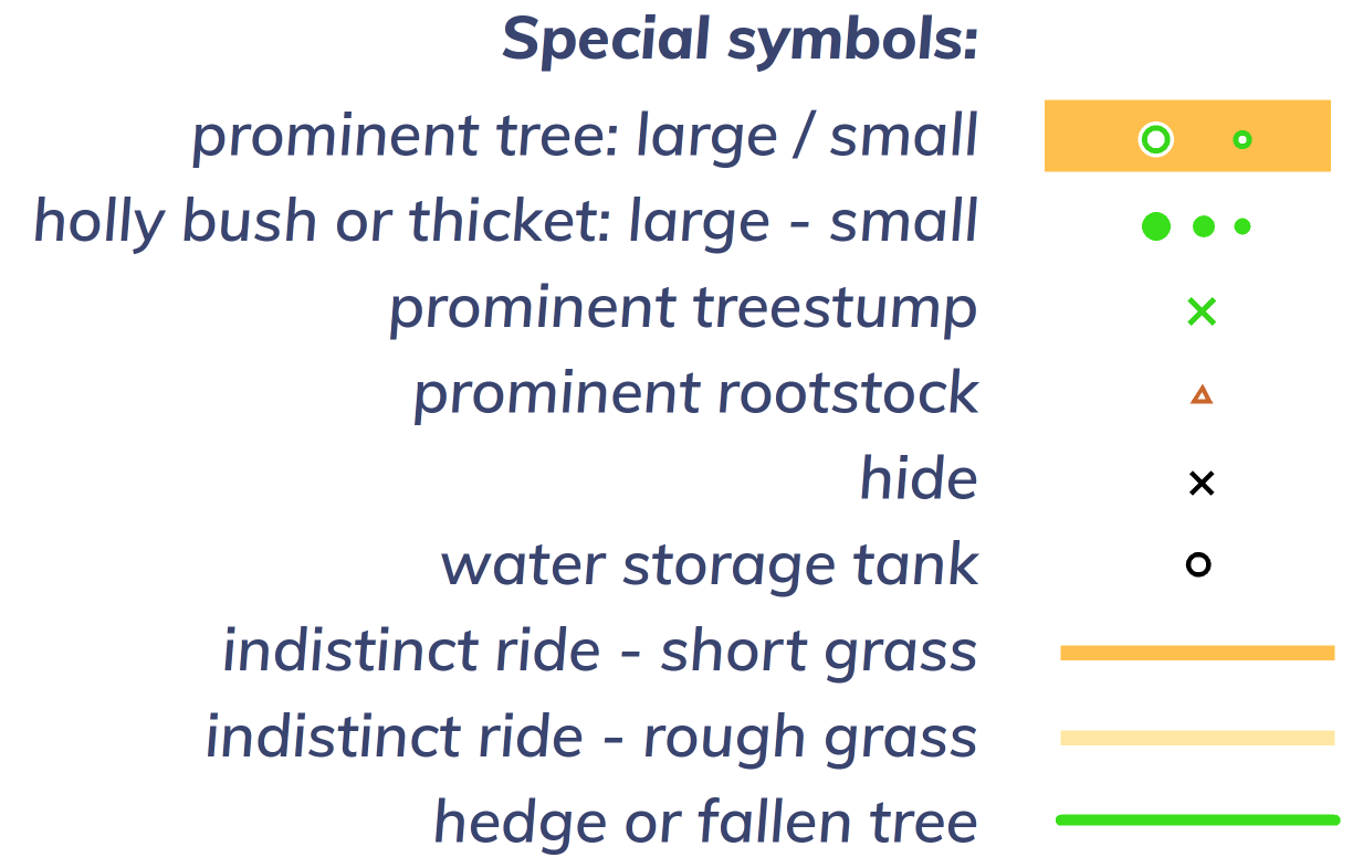
Map: 1:10,000 with 5m contours on waterproof paper and now with 2021 LiDAR based contours. ISOM 2017-2 map by Bruce Bryant with significant revisions in March 2025. The map has only a minimal legend, If you want a full legend, copies will be available from Enquiries in the Assembly area.

Terrain: Mature deciduous and coniferous woodland, with good contour detail and generally very runnable.
COVID:Please do not come if you have symptoms of Covid-19, or suspect you may have it.
Safety and Risk:
A risk assessment will have been carried out by the organiser, but participants take part at their own risk and are responsible for their own safety during the event. If you have a high risk medical condition you want organisers to be aware of please leave details at enquiries in a sealed envelope with your name on it. You can use this medical form. Envelopes will only be opened if required for a medical emergency. Unopened envelopes should be collected after the event. Any unclaimed envelopes will be destroyed after the event.
An emergency number for the day is printed on the map. First aid and details of the nearest A&E hospital will be available in the assembly area.
Photography:
British Orienteering has an agreed national guidance policy on the taking of photographs at events. If you are unsure about agreed acceptable practise please speak to the event organiser.
Privacy & Personal Data:
When entering events your personal details (name, age, gender, club) will appear in the results section on this website. It may also be used to trace missing runners and hired SI cards.
Organiser: Keith Willdig
Planner: Barry Elkington
Controller: Peter Hornsby (LEI)
Map
List of Dates (Page event details)
- Sun, 30 Mar 2025 10:30
Powered by iCagenda


